Foley Mountain Conservation Area
Length: 9 km trail system
Time: 3-4 hours
Terrain: Easy-Moderate
Located on the north shore of Upper Rideau Lake is Foley Mountain Conservation Area. With over nine kilometers of hiking trails and scenic views, the park has something for everyone. The entrance to Foley Mountain is off Country Road 10 just north of the Village of Westport and there is a $6.00 entry fee (per vehicle) which is payable by cash or credit.

A must see is the Spy Rock Lookout which is located near the first parking area (N 44 41.068 W 076 23.527). From the clifftop you get a full 180° view of the lake and Westport.
This parking area is also a great spot to start your hike as you have access to three different trails. To the north you can take the 1.3 km (loop) Beaver Trail which follows the shoreline of an old Beaver Pond. To the east is the 3 km Blue Circle Trail which takes you though wetlands and hardwood forests.
Located on the north shore of Upper Rideau Lake is Foley Mountain Conservation Area. With over nine kilometers of hiking trails and scenic views, the park has something for everyone. The entrance to Foley Mountain is off Country Road 10 just north of the Village of Westport and there is a $6.00 entry fee (per vehicle) which is payable by cash or credit.
A must see is the Spy Rock Lookout which is located near the first parking area (N 44 41.068 W 076 23.527). From the clifftop you get a full 180° view of the lake and Westport.
 |
| Spy Rock Lookout |
This parking area is also a great spot to start your hike as you have access to three different trails. To the north you can take the 1.3 km (loop) Beaver Trail which follows the shoreline of an old Beaver Pond. To the east is the 3 km Blue Circle Trail which takes you though wetlands and hardwood forests.
 |
| Beaver Pond |
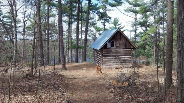
To the south is the 1.8 km White Pine Trail which takes you along the ridge line above Upper Rideau Lake towards the Interpretive Centre. This section is also part of Rideau Trail system which runs from Ottawa to Kingston. For the most part, this trail is quite easy and mostly downhill. There are a few soggy spots and in the Spring there could be streams crossing the trail.
 |
| White Pine Trail in the Spring |
If you're at the point where you need a break why not stop by the Interpretive Centre and learn about the park. Also located here is a second parking are (closed in the off season), washrooms and the wheelchair friendly, Mobility Trail. This short walk has views of the lake as well as information panels on how the region was formed.
Each trail is marked with their own unique identifier and maps can be found near both parking lots or with the scan of a smartphone (look for the QR code). Whether you're looking for a easy walk or a tough hike, Foley Mountain will not disappoint.
 |
| Mobility Trail |