Thursday, June 28, 2012

Pine Grove Trail

Pine Grove Trail (43 & 44)

Length: 5km loop
Time: 60-90 minutes
Terrain: Easy

Located in South Ottawa, Pine Grove Trail is part of the National Capital Commission (NCC) Greenbelt trial system. Parking can be found off Davidson Road at P18 (N45 21.292 W075 35.560) which is between Hawthorne Road and Conroy Road.


The hike is a 5 kilometer loop through natural forests, reclaimed white and red pine forests and marshlands. It should take between 60 and 90 minutes to complete following trails 43 and 44. Starting at the parking lot head north and cross Davidson Road to the beginning of the trail, here you'll see an information panel explaining the history or the forest. Before 1962, most of this area was cleared farmland. After it was purchased by the NCC both red and white pines were planted in most of the clearings and the area was eventually developed into a full grown forest.

Heading north on 43, the first kilometer of the trail is a gravel covered. This is part of the Greenbelt pathway which will eventually run from Greens Creek in the east end of Ottawa to the Shirley's Bay in the west. As you walk make sure you take a few moments and read the panels which describe the different trees in the forest.

One of the best parts of this trail are the new signs that are located at all intersections. As the gravel path heads east continue on 43 (to the north) to where it changes into a grass/dirt covering.


As you follow the trail you'll eventually pass by a large marsh on your left. There are a few spots where you can sneak through the brush get a better look but beware, the closer you get the more mosquitos you'll anger. After another five minutes you'll arrive at another intersection, turn left and keep going on 43.

Keep heading south through the old natural forest until you reach Davidson Road. From here you have two options... 1. You could cross the road go over a small bridge onto a narrow, not well maintained trail, or... 2. Go left and follow the road for about 100 meters until you reach the opening on the left. Personally, I chose the road... it was a nice break from the bugs.

From here the trail keeps heading south. If you're getting tired you have the option of cutting the hike short. At the intersection of trail 43 and 44, if you turn left you will reach the parking lot after only a few minutes. If you're still up for the hike go straight through onto trail 44. This part of the walk brings you around a very large marsh with a few boardwalks, some gerat views and lots of mosquitos.


The trail follows a southern flow for a kilometer until you make it around the marsh then it heads straight north towards the parking lot. Along this stretch there are a lot of side trails which will take you to side street parking on Hawethorne Road as well as other parts of the Pine Grove Trail System. Stay on 44 as this is the only one that leads you back to P18.

In conclusion, Pine Grove Trail is a great hike for beginners and families. It offers some very easy terrain, some nice scenery and is by far one of the best kids in the Ottawa Green Belt.


Monday, June 11, 2012

Lake Whittaker Conservation Area

Lake Whittaker - Sinking Bridge Trail and Ivan Row Trail

Length: 3km of hiking trails (5km with total loop of Lake)
Time: 60-90 minutes
Terrain: Easy to Moderate

Located in South-West Ontario near the hamlet of Avon, Lake Whittaker Conservation Area is a nice wooded esacpe in the middle of farm country. The 26-acre lake supports a public beach, camping, fishing and several kilometres of hiking trails.

The entrence to the conservation area is located at the end of Whittaker Lane. There is an $8.00 entry fee (per vehical) to gain access for the day. Once you're all paid up turn left around the gatehouse and follow the road along the south side of the lake to the day-use parking area (GPS Location: N 42 54.720 W080 57.587).

The two trails will take you on a 5 kilometre (3 km of hiking trail, 2 km of road) loop of the lake. From the day-use parking lot, walk the wooded trail and end up at the public beach in the camping area. From the beach, back to the parking area, walk along the road.

Starting at the day-use parking lot, head towards the lake and through the gate. Welcome to Sinking Bridge Trail.

The first few hundred metres of the path are quite simple... it's wide, grass covered and quite flat. Make sure you check out the fishing piers to the right as they give you a great view of the lake. Also along this stretch is a nice pinic area with lots of tables, this is a great spot to sit and relax after the hike.

Photos Provided by Jamie Limebeer Photography

After a few minutes you'll arrive at the end of a road and the trail will make a sharp right and down a hill. This part of the trail is actually the old allignment of the road and at the bottom of the hill was an old floating bridge that crossed the wetlands.

Now this is where the trail starts getting a little more difficult. Before reaching to bottom of the hill there is a small un-marked entrence to your left. It may not look like much but things open up after few minutes. This part of the hike is takes you along some very interesting terrain as well as grassy meadows, over boardwalks and through old hard and soft-wood forests.

Photos Provided by Jamie Limebeer Photography

By this point you've probably noticed that the trail is not marked that well (or at all) and the map available at the gate-house is not a good representation of the trail. As you walk through this part of the woods you're probably wishing things were advertised a little better. Over the next few minutes you'll find many forks in the trail. From what I saw, most lead back to the main trail but use the attached map below to help you find your way.

Photos Provided by Jamie Limebeer Photography

Continue along the route until you reach the old alignment of road again, this will mark the end of the Sinking Bridge Trail but not the end of the hike. Follow the grassy road until you see a sign for the Ivan Row Trail and make a right into the second half.

Ivan Row Trail is a little different then the Sinking Bridge Trail, it follows much closer to the the lake and can get quite muddy as you make your way through some marshlands. Though the trail is not marked (except for the entrance and exit) it is much easier to follow with no side trails to confuse you. As you near the campground section of the park the trail will turn into a mountain biking area with several jumps and hills. If you stay to the right you'll see the exit which brings you to the public beach and some washrooms.

That marks the end of your hike. To get back to the day-use parking lot follow the road to your east, past to the gatehouse and along the south of the lake.

Lake Whittaker Conservation Area is a great spot to spend an afternoon. The trails allow you too see a rare part of Southern Ontario. The only negative is the lack of signage along the trail but the scenery by far makes up for this. Enjoy.

Lake Whittaker Map


Wednesday, May 30, 2012

The Mer Bleue Bog Trail

Mer Bleue Bog Trail

Length: 1.2 km loop
Time: 45-60 minutes
Terrain: Easy

Welcome to the Mer Bleue Conservation Area. Located south-east of downtown Ottawa, Mer Bleue is little piece of north hidden in the south. The area features a number of hiking trails including the Bog Trail Boardwalk. Parking for the boardwalk is located at the end of Ridge Road, which is off Anderson Road.

The hike is a 1.2 km loop and takes about 45 minutes. The terrain is pretty easy, for most of the hike you're on flat wooden plank with only the last few hundred metres being on old fashioned dirt. Dogs are not allowed.

When you arrive at the parking lot head south past the outhouse towards the bog. Along the way there are a number of information panels explaining the history and science of the bog. You'll eventually arrive at a series of four panels at a fork in trail, from here turn right and the boardwalk is right there.

Photos provided by Jamie Limebeer Photography

Mer Bleue is actually an ancient channel of the Ottawa River. During the last ice age this area was under several kilometres of ice, when the glacier receded this new part of the Ottawa River was created. Over time the flow changed and thus the Mer Bleue Bog was born.

As you cross the open water along the boardwalk you'll notice the trees and plants ahead of you are a little different than what you just saw near the parking lot, that's because they are. Mer Bleue is a boreal peat bog, some flora can't grow here where others thrive. As you continue along the trail you'll notice trees such as black spruce and tamarack as well as ground cover or blueberries and cottongrass... these are normally located in more northern climates.


Photos provided by Jamie Limebeer Photography


As mentioned earlier, this trail is a loop so you'll eventually be sent back towards the ridge. But before that happens you'll be treated to a nice close-up of an old beaver lodge. Of all my years of coming to the bog I have never seen a beaver using this lodge but don't be surprised of you see any swimming around. The area is very active with wildlife... it not uncommon to see muskrat, turtles and even the odd moose. If you're a photographer, this is a great area for taking shots of animals.
Photos provided by Jamie Limebeer Photography

As you near the end of the boardwalk it means your hike is almost over. The last few hundred metres are in the woods along the edge of the ridge overlooking the bog. This spot provides a few great views of the marsh as well as few spots to sit down for a picnic.

Photos provided by Jamie Limebeer Photography
Enjoy your hike at the Mer Bleue Bog Trail.

Monday, May 7, 2012

Gatineau Park - The Wilson "Carbide" Mill Trail

The Wilson "Carbide" Mill Trail

Length: 3 km (round trip)
Time: 120 minutes
Terrain: Moderate

Gatineau Park is located in the Gatineau, Quebec just north of the Nation's Capital. For both locals and tourists this is a vey busy spot. In the winter it is full of cross country skiers and snowshoers. In the summer it is loaded with mountain bikers and of course hikers. With over 160 kilometers of trails you'll never run out of something to do. My first trail review of the park will be a short hike to the Wilson "Carbide" Mill.

The trail starts at the O'Brien parking lot located off Meech Lake Road. In the off season it is typically free to park but on a nice summer day expect to pay. Before taking off make sure you take advantage of the washrooms as this is it until you make it to your destination and back.

The trail is actually part of the Trans-Canada Trail system which will eventually reach from coast-to-coast-to-coast. It is a well maintained trail with only a few moderate hills to slow you down. In total, give yourself about 2.5 hours to complete this 3km round trip hike, this includes the time you'll spend taking pictures at your destination.


As you leave the parking lot you'll be treated to your first hill, it is short but a little steep so take your time and enjoy a breather at the first information panel located about 100 metres past the top. Once you continue down the trail you'll see a sign for a steep hill, don't worry this one goes down... But don't forget, you'll eventually have to come back

At the bottom of this hill you'll cross a bridge where you'll be treated to a nice view across Meech Lake. Make sure you read the panels as they are full of info about the regions interesting past. Once you are done, continue down the trail.


After a few minutes of walking a short uphill you'll come to an unmarked trail on your right which leads to the Wilson "Carbide" Mill. You'll know you're at the correct spot when see a signpost at the fork telling you that you're 1km from the parking lot. Turn right and continue down the path.

This trail is quite flat but a little more rugged the the main trail. After a good rainfall or in the spring it can get quite muddy.

After five minutes of hiking you'll spot the old ruins on you're left, the trail will take you right to them. Now that you've made it take lots of time to enjoy the area. There is a beautiful waterfall, an old dam and the shell of what used to be a carbide mill.


The mill was built by Canadian inventor Thomas Wilson in 1911. Originally from Princeton, Ontario, Wilson discovered a process for creating calcium carbide, which is used in the production of acetylene gas.


The only downside of the area is that it is known spot for nude swimmers. If you have small children make sure you always keep an eye on what's around them. The park management is well aware of the problem and have regular patrols to the area as well as signs to discourage those looking to take a dip.

After you're done it's time to turn around and head back down the trail towards the parking lot. Don't forget, the big hill you came down is now a big hill you have to climb up. I like to stop at the bridge and take a drink of water before making the trek up. Once at the top the parking lot is only a few minutes away.

I hope you enjoy taking this hike as much as I do and remember to pack the correct gear and have a good time.

Saturday, March 31, 2012

Rock Dunder Trail

Dunder Rock Trail

Length: 3 km (round trip)
Time: 120 minutes
Terrain: Moderate to Difficult

Spring has arrived in Eastern Ontario and that typically means two things to me... The NHL playoffs are just around the corner and hiking season is here.

Today's conquest was Rock Dunder. Located in Morton, Ontario, Rock Dunder is great hike that both the young and old can enjoy. Taking the path described below takes about two hours and is about five kilometers long, round trip. Trails are marked with blue arrows. At the summit you'll enjoy one of the best views in the area.

Parking can be found just south of the small town of Morton at the end of an unmarked road. At the beginning of the trail is a outhouse, a few benches and a map of the trails. Not that they are difficult to remember, but I would still suggest taking a picture of the map for future reference. You never know when you'll need it.

From the parking lot there are two ways to reach the summit, I chose the Cabin One trail which in turn continues onto the Summit trail. The first kilometer of the hike is fairly flat with no real challenges. As you approach the first cabin you get a great view of the bay which means you're getting close to the more difficult parts.

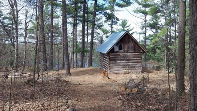
Cabin One


But even though the trail becomes more challenging you'll still have no issues. After the cabin the path starts to follow along the bay about 10 metres above the water level, rising higher in some points. Here is where you get you're first great view of the region. Make sure you take a few minutes at each of the courtesy benches to take in the amazing scenery.


As you get closer to the top the trail will turn from moderate to difficult. Be aware of what's ahead and take your time, you're far from the parking lot and no one wants to get hurt.

Moderate to Difficult


The last five minutes of the hike are the hardest. In a short five minutes you climb about 50 vertical metres to the summit. You know you're getting close when the trail turns from dirt to smooth rock.

But now you're finally here, you reached the summit of Rock Dunder. Take some time and enjoy the views and make sure you take lots of photos. On a nice clear day you can see as far as the 1,000 Islands Tower near the US border. Also, be sure to watch you're footing around the ledges, it's a long, steep way down.

After you've enjoyed your time at the top turn around a head back down the trail and back to the car knowing you reached the summit of Rock Dunder.


View from the Summit